About
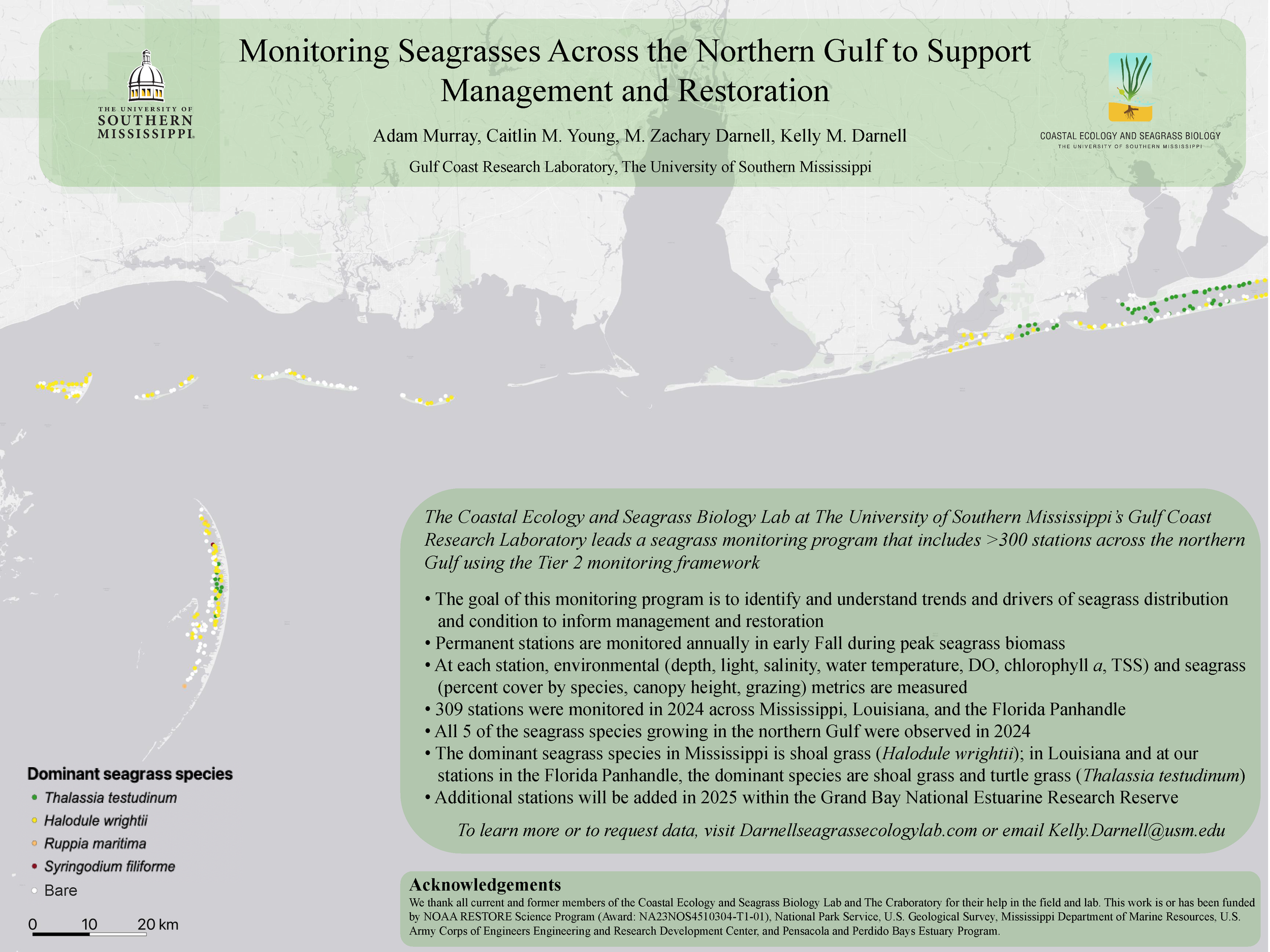
The Coastal Ecology and Seagrass Biology Lab leads a seagrass monitoring program at more than 300 stations across the northcentral Gulf using the tiered seagrass monitoring approach. This program was established in 2018 with the goal to identify and understand trends and drivers of seagrass distribution and condition to inform management and restoration.
We monitor seagrass:
Across its distribution in Mississippi, which spans all the Mississippi barrier islands (including the Gulf Islands National Seashore) and in the Grand Bay National Estuarine Research Reserve (starting in 2026)
At the Chandeleur Islands in Louisiana, which is the only location with true seagrass in Louisiana; and
Along the Florida Panhandle from Perdido Bay to Okaloosa Island, FL, inclusive of the Florida islands of the Gulf Islands National Seashore.
Tiered seagrass monitoring approach
Our program follows the seagrass monitoring protocol developed for the Inventory and Monitoring Division Gulf Coast Network of the National Park Service. This protocol is based on the Tiered Seagrass Monitoring Framework proposed by Neckles et al. (2012) and includes:
Tier 1 remote sensing to delineate seagrass distribution
Tier 2 rapid-assessment field-based monitoring to identify changes in seagrass distribution and condition; and
Tier 3 studies to investigate processes driving changes observed in Tier 2 and Tier 1 sampling
We visit each of the 300+ stations in the Northcentral Gulf Seagrass Monitoring Program annually to monitor a suite of suite of seagrass metrics and environmental drivers of seagrass condition using the rapid-assessment field-based Tier 2 approach (see below).

Tier 2 seagrass monitoring diagram created by Caitlin Young.
maximizing use of our monitoring data
The seagrass monitoring program spans three states (Louisiana, Mississippi, and Florida) and 200 km of coastline, which enables us to leverage monitoring efforts to answer a range of ecosystem questions across broad scales. Our program builds off a seagrass monitoring program led by Dr. Ken Heck and Dottie Byron, M.S. that began in 2011 and focused on seagrass within the Gulf Islands National Seashore, which provides more than 10 years of data for 100+ locations in Mississippi and Florida.
Data from the monitoring program have been used for a range of applications, including:
Monitoring and adaptive management in partnership with the Mississippi Coastal Improvement Program for Comprehensive Barrier Island Restoration through the U.S. Army Corps of Engineers Coastal Infrastructure Program (MsCIP)
Detecting long-term trends in coastal natural resources for the Gulf Islands National Seashore
Maximizing benefits of restoration of the Chandeleur Islands, LA
Novel applications of emerging techniques to examine seagrass distribution changes over time
We also partner with other seagrass monitoring programs and participate in a variety of working groups to share data and leverage resources when possible. Check out these other fantastic programs:
Texas Seagrass Monitoring Program
Gulf of Mexico Seagrass Monitoring Community of Practice
Coastal and Estuarine Research Federation’s SAV Mapping/Monitoring Community of Practice
Sponsors
The Northcentral Gulf Seagrass Monitoring Program is possible with funding from a several agencies and organizations:


For more information
Contact the Northcentral Seagrass Monitoring Program Lead, Kelly Darnell (Kelly.Darnell@usm.edu)